Navigation Skills
Land Navigation Without GPS: Map, Compass & Essential Skills
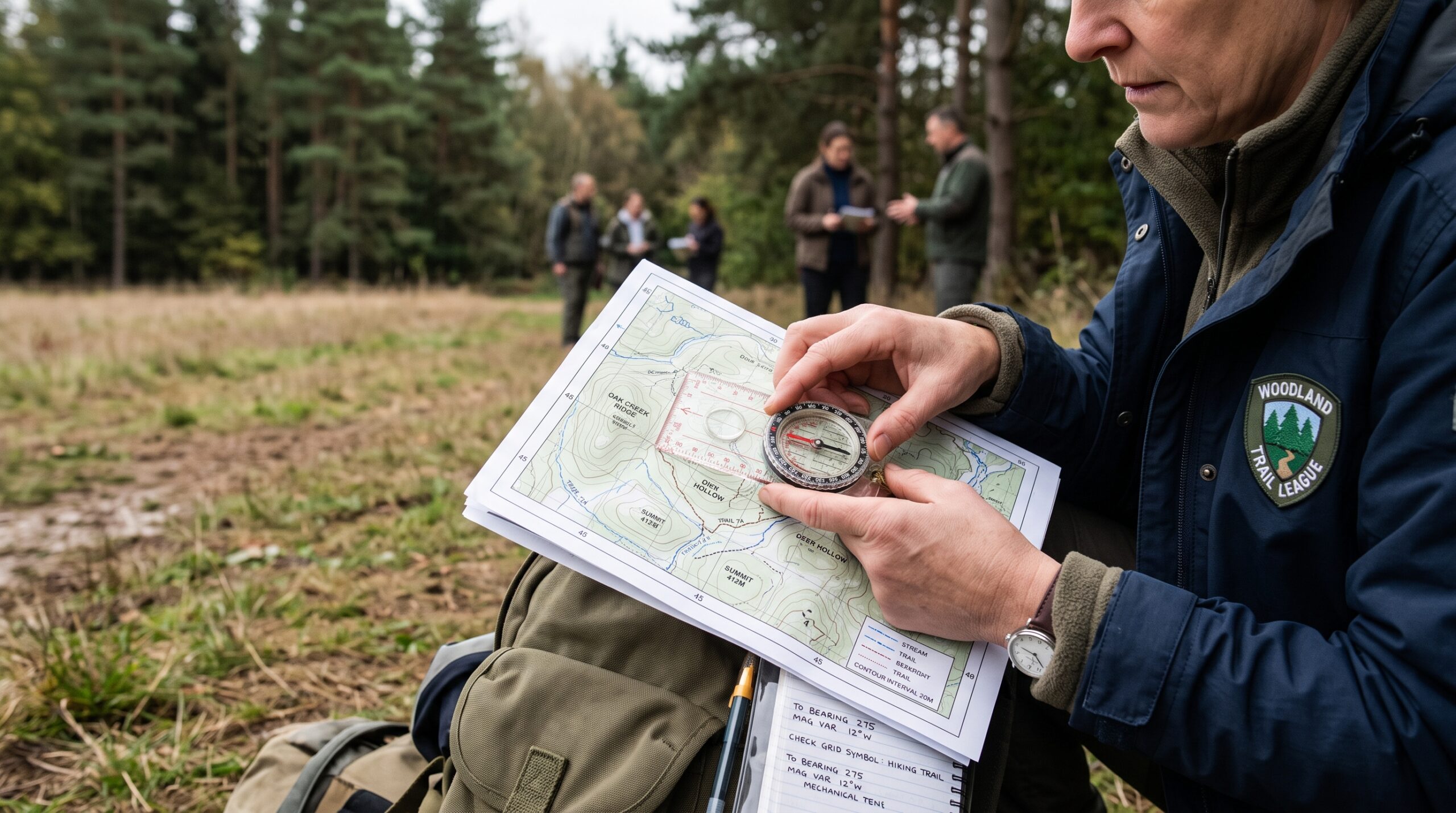
Short answer: reliable land navigation does not require GPS. With a topographic map, a quality compass and the ability to work with bearings, magnetic declination, terrain features, distance and coordinates, you can navigate even when your phone, GPS receiver or other electronic navigation tools are unavailable.
For emergency preparedness, land navigation is more than a wilderness skill. It can help you follow an evacuation route, identify alternate routes, locate water or shelter, navigate around blocked roads and maintain your position when electronic navigation fails.
Why learn land navigation if you already have GPS?
GPS and smartphone navigation are extremely useful, and there is no reason to avoid them during normal operations. The preparedness problem is dependency.
Phones can run out of power, break, become inaccessible or lose the mapping data you expected to use. A dedicated GPS receiver also depends on batteries and functioning hardware. A paper map and magnetic compass provide an independent navigation layer that does not require a cellular connection or electrical power.
The objective is therefore not to replace GPS. It is to build navigation redundancy: GPS when available, map and compass when needed, and enough terrain awareness to avoid becoming completely dependent on either.
The six land-navigation skills that matter most
1. Read a topographic map
A topographic map represents terrain through contour lines. Learning to recognize ridges, valleys, saddles, peaks, depressions and steep versus gradual slopes allows you to convert a two-dimensional map into a mental model of the terrain around you.
This skill also enables terrain association: identifying your location by comparing visible terrain with features represented on the map.
2. Understand grid coordinates
Coordinates allow you to describe a location precisely rather than saying that something is “near the river” or “north of the road.”
For maps using the Universal Transverse Mercator system, a UTM grid tool or map protractor can make plotting and reading coordinates significantly easier.
3. Take and follow a bearing
A bearing describes a direction relative to north, normally expressed from 0° to 360°. A compass allows you to determine that direction in the field and maintain it while moving.
The practical skill is not simply reading the number on the compass. You need to select distant reference points, move toward them, reassess your position and avoid accumulating directional error.
4. Correct for magnetic declination
A map normally references true or grid north while a magnetic compass points toward magnetic north. The angular difference is magnetic declination, and ignoring it can create substantial positional error over distance.
Declination varies by location and changes over time. Check a current authoritative source or recent map for the area where you intend to navigate.
5. Estimate distance
Knowing direction without knowing distance is not enough. Land navigators commonly combine map distance with real-world techniques such as pace counting and travel-time estimation.
Your pace count should be established experimentally because terrain, slope, vegetation, fatigue and load can all affect it.
6. Maintain situational awareness
Good navigation is not a repeated sequence of staring at the compass. Continually compare the map with terrain, identify major features, anticipate what you should encounter next and periodically confirm your position.
This reduces the chance that a small navigation error develops into a large one.
Best compasses for land navigation
Affiliate disclosure: This page contains affiliate links. If you purchase through these links, we may earn a commission at no additional cost to you.
Best Overall: Suunto MC-2
The Suunto MC-2 is our preferred all-around compass for preparedness, hiking and serious map work. The northern-hemisphere USGS version combines a transparent baseplate with adjustable declination, mirror sighting, a clinometer, magnifying lens and USGS UTM scales.
It is particularly useful if you want one compass that works well both on the map and when taking precise bearings in the field.
Find it on AmazonBest Lensatic Compass: Cammenga 3H
The Cammenga 3H is a rugged lensatic compass built around the military style of land navigation. Its aluminum frame, induction-damped needle and self-powered tritium illumination make it particularly suited to demanding field use.
Choose it if you specifically want to learn lensatic-compass techniques rather than conventional baseplate navigation.
Find it on AmazonAlternative Mirror Compass: Silva Ranger 2.0
The Silva Ranger 2.0 is another serious mirror compass for users who want accurate sighting combined with conventional map work.
It is a useful alternative to the Suunto platform and is better suited to traditional map-and-compass navigation than a basic recreational compass.
Find it on AmazonCompass types: baseplate vs. lensatic
| Feature | Baseplate / Mirror | Lensatic |
|---|---|---|
| Example | Suunto MC-2 | Cammenga 3H |
| Map work | Excellent | Requires different techniques/tools |
| Precise sighting | Excellent with mirror compass | Excellent |
| Learning curve | Relatively straightforward | More specialized |
| Typical user | Hiker, prepper, navigator | Military-style land navigation |
| Our recommendation | Best starting system for most people | Best if specifically learning lensatic navigation |
Neither design is inherently “better.” They support somewhat different navigation workflows. For most civilians building their first serious land-navigation kit, a quality baseplate or mirror compass such as the Suunto MC-2 is generally the more intuitive starting point.
The small tool that makes UTM easier
UTM Map Protractor
A transparent coordinate protractor is inexpensive but extremely useful when working with maps that use UTM or military-style grid systems. It helps plot coordinates, measure directions and work precisely with the map grid.
Keep one with your maps rather than relying on improvised measurements in the field.
Find it on AmazonLand-navigation manuals worth owning
A compass is only useful if you know how to use it. For a preparedness library, a printed land-navigation manual has an additional advantage: it remains available when internet access is not.
TC 3-25.26 — Map Reading and Land Navigation
A detailed reference for learning military-style map reading and land-navigation concepts. It is particularly relevant if you intend to train with grid coordinates, terrain features, azimuths and structured land-navigation exercises.
Find it on AmazonUS Army Map Reading and Land Navigation Handbook
A convenient printed reference for keeping land-navigation instruction in your preparedness library or training kit.
Find it on AmazonA practical land-navigation kit
You do not need a large collection of specialized equipment to begin training. A useful basic kit consists of:
- Quality compass: preferably with adjustable declination.
- Topographic map: covering the area where you actually intend to travel.
- UTM/grid protractor: where appropriate for the map system.
- Pencil: for plotting positions and notes.
- Notebook: for bearings, coordinates, pace counts and route planning.
- Printed navigation reference: kept with your preparedness library.
- GPS or smartphone: useful as the primary or verification layer when available.
How to train land navigation
- Learn the symbols, scale and contour lines on your local topographic map.
- Learn how your compass works before attempting a navigation exercise.
- Check the current magnetic declination for your training area.
- Practice orienting the map to the terrain.
- Practice taking a bearing from the map and following it in the field.
- Establish your approximate pace count over a known distance.
- Practice identifying terrain features without using GPS.
- Progress to short routes with multiple checkpoints.
- Use GPS to verify your work after completing the exercise rather than relying on it continuously.
Start in familiar, low-risk terrain. Do not make your first map-and-compass exercise an attempt to navigate through remote wilderness.
Common land-navigation mistakes
- Ignoring declination: small angular errors become larger positional errors over distance.
- Following the compass constantly: use identifiable terrain and distant reference points whenever possible.
- Failing to track distance: direction alone does not tell you where you are along that direction.
- Using outdated maps: roads, trails, buildings and other human-made features change.
- Keeping no record: write down important bearings, coordinates and route decisions.
- Practicing only theoretically: land navigation is a practical skill and must be exercised outside.
Frequently asked questions
Can you navigate without GPS?
Yes. A topographic map and magnetic compass can be used to determine direction, follow bearings, identify terrain and maintain a route without GPS. Effective navigation requires training and practice rather than simply carrying the equipment.
What is the best compass for emergency preparedness?
For most users, we prefer a quality baseplate or mirror compass with adjustable declination. The Suunto MC-2 is our current all-around choice because it combines conventional map work with precise sighting, adjustable declination and UTM scales.
Is a military lensatic compass better?
Not necessarily. A lensatic compass such as the Cammenga 3H is excellent for the navigation techniques it was designed around, but a transparent baseplate compass is often easier for civilian topographic-map work. Choose the compass type that matches the navigation system you intend to learn.
Do I still need GPS if I know map and compass?
GPS remains extremely useful. Preparedness is better served by redundancy than by deliberately rejecting modern navigation tools. Learn map and compass so that GPS becomes one navigation layer rather than your only navigation capability.
Our recommendation
If you are starting from zero, buy one good compass rather than several cheap ones. For most people, our starting choice is the Suunto MC-2, paired with a topographic map of the local area and a UTM/grid tool appropriate to that map.
Then spend your money on practice rather than accumulating navigation equipment. Being able to orient a map, identify your position, compensate for declination, determine a bearing and navigate between known points is considerably more valuable than owning an expensive compass you have never used outside.
Sources and methodology
Product characteristics were checked against current manufacturer documentation where available. Equipment recommendations are Portuguese Prepper editorial judgments based on suitability for map work, field navigation, redundancy and preparedness use.
Reviewed: September 2026. Compass models, specifications and retail availability can change.